In Gaza, traveling from north to south, or trying to make the journey back, is no longer simply a matter of finding a road.
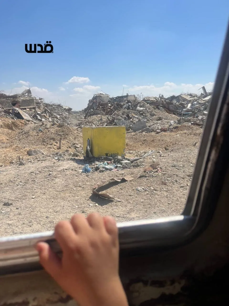
It means watching the yellow concrete blocks.
It means looking for Israeli military positions.
It means listening for gunfire.
It means wondering whether the road that was open yesterday will still be accessible today.
And for Palestinians living along the route, it means living with the fear that the line separating them from Israeli-controlled areas could move closer to their homes at any moment.
On October 10, 2025, Israeli forces completed the first phase of their withdrawal under the so-called US President Donald Trump’s ceasefire deal to the so-called “Yellow Line” — a non-physical demarcation line intended to separate Israeli forces from certain areas of Gaza. At the time, the arrangement left Israeli forces occupying more than 53% of the Strip.
Since the ceasefire, Israeli forces have repeatedly advanced the so-called line westward, expanding the area under their control and further restricting Palestinian movement.
The latest advances have been reported along Salah al-Din Road, making an already precarious state of limbo increasingly dangerous for Palestinians.
The line has crept forward in several areas, expanding the territory under Israeli military control beyond the roughly 53% indicated in the original ceasefire maps, according to reporting by The Guardian.
Research by Forensic Architecture found that Israel had taken control of approximately 58% of the Gaza Strip by December and continued advancing westward.
Israel now controls more than 60% of the enclave, while Israeli Prime Minister Benjamin Netanyahu has said the aim is to increase that figure to around 70%.
The result is a Gaza increasingly divided into two zones: an eastern area under Israeli military control and a western area where Palestinians live, many of them forcibly displaced, under the continuing threat of Israeli attacks.
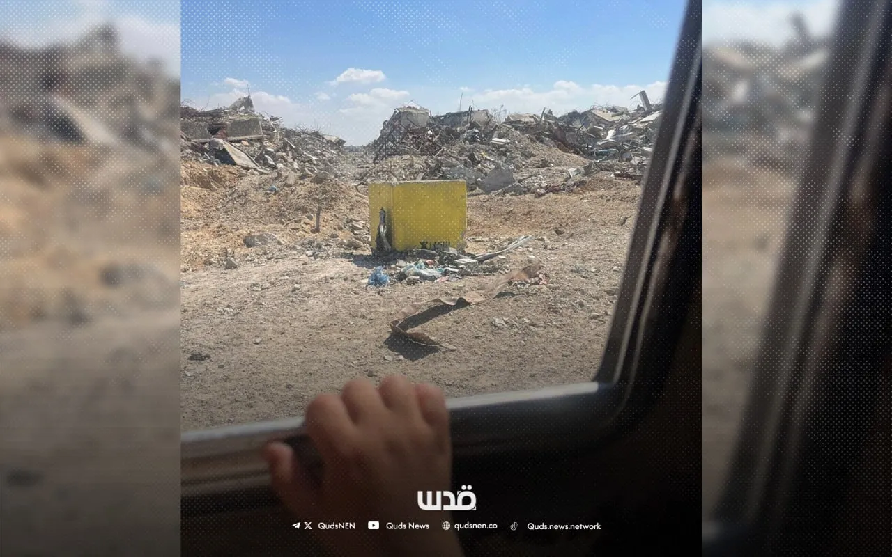
Israel began marking the line with concrete barriers and yellow-painted blocks, generally placing the markers about 150 to 200 meters apart.
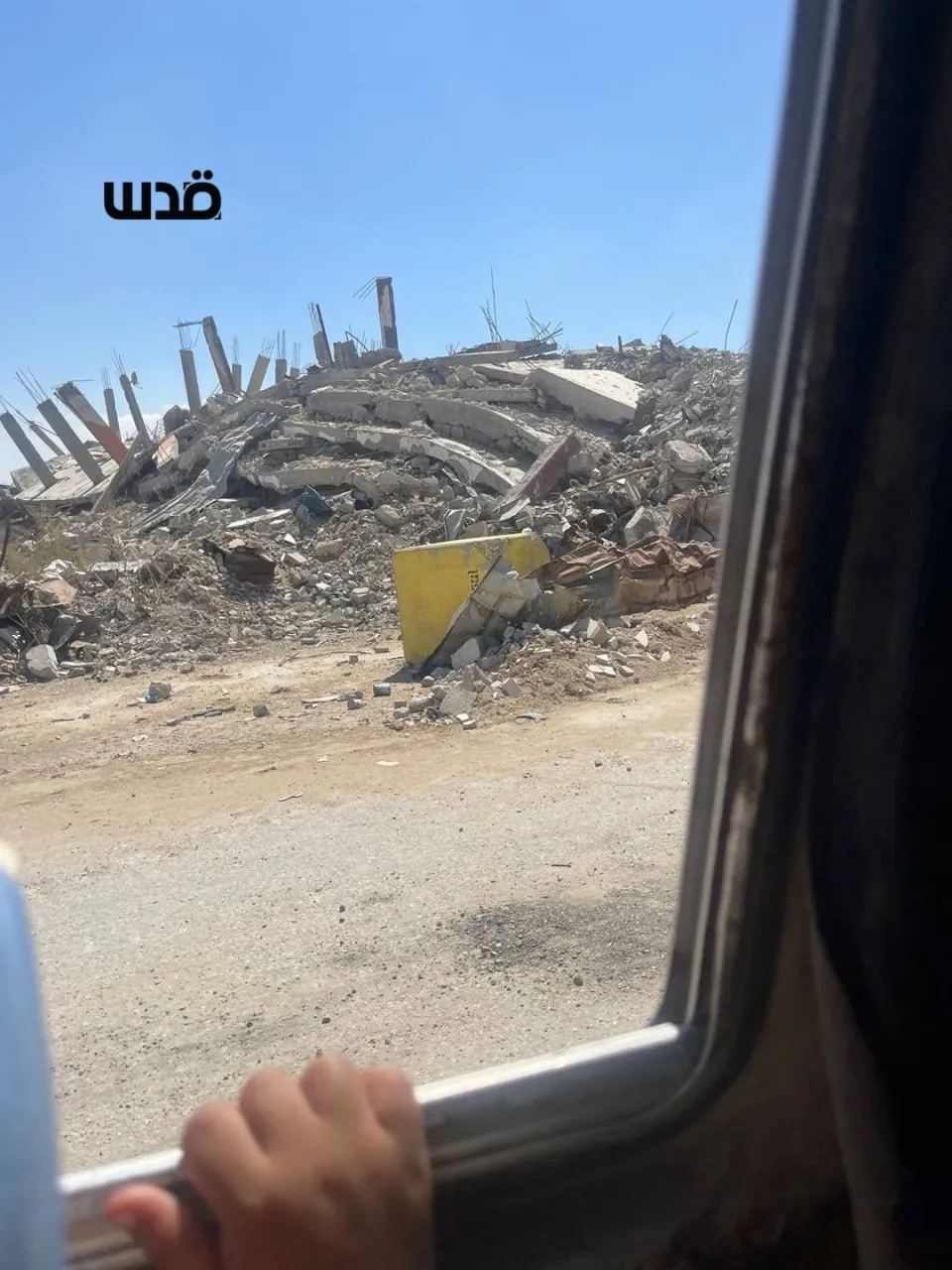
But what began as a military demarcation has increasingly become a physical presence in Palestinians’ daily lives: enormous yellow blocks cutting across roads, fields, neighborhoods and the ruins of homes.
And when the blocks move, people move with them.
Salah al-Din Road: From Lifeline to Boundary
Salah al-Din Road runs through the length of Gaza and has long been one of the Strip’s main north-south arteries.
For Palestinians, it is more than a road.
It connects families separated by Israel’s genocide in Gaza. It links people to hospitals, markets and relatives. It is a route for ambulances, aid workers, humanitarian and commercial trucks, taxi drivers and civilians trying to move between the northern and southern parts of the Strip.
But the advancing Yellow Line has increasingly reached the road itself.
In April, reports documented Israeli forces moving the line toward the edge of Salah al-Din Road, with yellow blocks placed alongside the route. The development forced drivers and civilians to rely more heavily on Gaza’s damaged coastal road, which is narrower, congested and difficult to navigate.
The road therefore no longer simply connects Gaza’s north and south.
In some places, it has become a boundary separating civilians from the territory immediately beyond the yellow blocks.
For anyone traveling through Gaza, the journey has become a calculation:
Where are the blocks?
Where are the Israeli forces?
Has the line moved?
Is it safe to continue?
A Few Meters Can Change Everything
Nour Mohamed told Quds News Network that the last time she traveled to Al-Maghazi refugee camp in central Gaza along the road, it was nearly deserted.
“The road was almost empty. It looked like a desert, with debris everywhere and so much destruction,” she said.
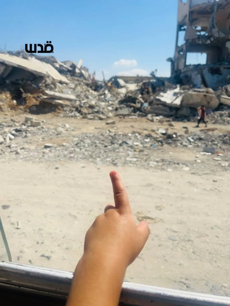
On Sunday, September 27, Nour said she and other drivers and families were returning along the road when they reached a point where they saw Israeli tanks firing gas canisters and opening fire intensively.
Local sources also reported that Israeli-backed militias stationed near the road were opening fire.
“The way was like a horror movie. We were staring death in the face,” Nour told QNN.
At one point, a driver warned them: “Go back, go back. There’s an Israeli tank ahead firing gas bombs. It’s very dangerous.”
Nour said her two young sons were terrified.
“My two little sons were very afraid. They kept crying and asking, ‘What is happening?’”
For Palestinians traveling through Gaza, a journey that once took minutes can now become a confrontation with an unpredictable Israeli attack.
In July, residents in Zeitoun, Tuffah, Deir al-Balah, Khan Younis and northern Rafah said Israeli forces had moved the yellow markers forward, prompting new waves of displacement.
In Zeitoun, residents said the line had reached Salah al-Din Road and that families were fleeing once again.
For a family already displaced multiple times, the movement of a concrete block can have consequences far beyond the few meters it travels.
A tent can suddenly become too close to a military position.
A road can become inaccessible.
A field can become unreachable.
A home can become too dangerous to approach.
And a family can once again be forced to pack whatever remains of its belongings and move.
The blocks themselves have become a haunting feature of Gaza’s landscape.
For six-year-old Adam, they have become something he recognizes immediately. Adam marks the yellow blocks whenever he sees them, his mother said.
“Every time he sees one, he says, ‘Here is another one. Here are the Israeli occupation forces.’”
The yellow markers have become so familiar to him that they have entered the vocabulary of his childhood.
Yet on another road, the six-year-old tried to reassure his younger brother.
“On our way along the coastal Rashid Road, Adam told his younger brother, ‘Here is the sea. Here there are no Israeli forces or bombs.’”
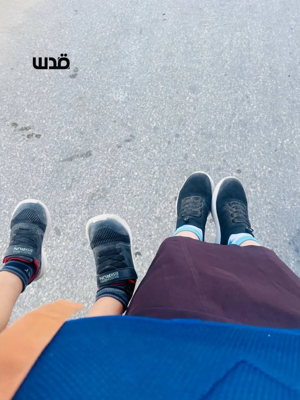
The words of a child reveal the geography Gaza’s children are being forced to learn, not through maps or classrooms, but through identifying where Israeli occupation forces who kill their people are present and where they believe they might be safe.
Painted bright yellow, the concrete blocks stand out against the gray of destroyed buildings and the brown earth surrounding displacement camps.
They were introduced as markers.
But for Palestinians, they have become reminders of a shrinking space in which to live.
On the ground, however, Palestinians describe a very different experience from that of a fixed military boundary: uncertainty over where the line begins, where it ends and whether it will remain in the same place.
In July, residents said the blocks were sometimes moved without notice, while satellite analysis by Forensic Architecture found markers in some locations hundreds of meters beyond the original line.
“Where Do We Go?”
For Palestinians living near the Yellow Line, another question has become increasingly difficult to answer:
Where do we go?
A September report by UN News described families living only a few meters from yellow concrete blocks in eastern Gaza City. Residents said they had repeatedly been forced to leave, return and then leave again as the line shifted closer.
The UN said Palestinians were living on less than 40% of Gaza’s land area, while almost the entire population remained displaced.
For families who have already fled their homes multiple times, there are few places left to go.
The space behind them is marked by destruction.
The space ahead is increasingly restricted.
And the boundary between the two continues to shift.
Satellite imagery reviewed by Haaretz in July showed an earthen barrier extending almost a mile beyond the Yellow Line in one area.
Meanwhile, the UN has reported that restricted areas have expanded significantly since the ceasefire began
For Palestinians trying to travel from north to south, or south to north, it is an ever-present question:
How much farther will the line move?
And, ultimately:
How much space will be left for Palestinians to live and move freely?